Know The Project
Know the project
About Oxbow
At Walton, we see the demand for strong and sustainable communities that provide new housing, workplace and commercial opportunities within the greater Calgary region. The lands purchased by Walton at the east end of Dunbow Road adjacent to the Bow River offer the potential for implementation of a complete community.
The Oxbow lands will be developed to support a comprehensively planned community that will provide residents with a diversity of amenities, open spaces and housing options within a neighbourhood village setting.
The Oxbow Area Structure Plan (ASP) will guide the development of the Oxbow lands. We will work closely with our neighbours to ensure that the amenities, services, and housing options will compliment and contribute to the growth of the community and surrounding region for future generations.
Site Context
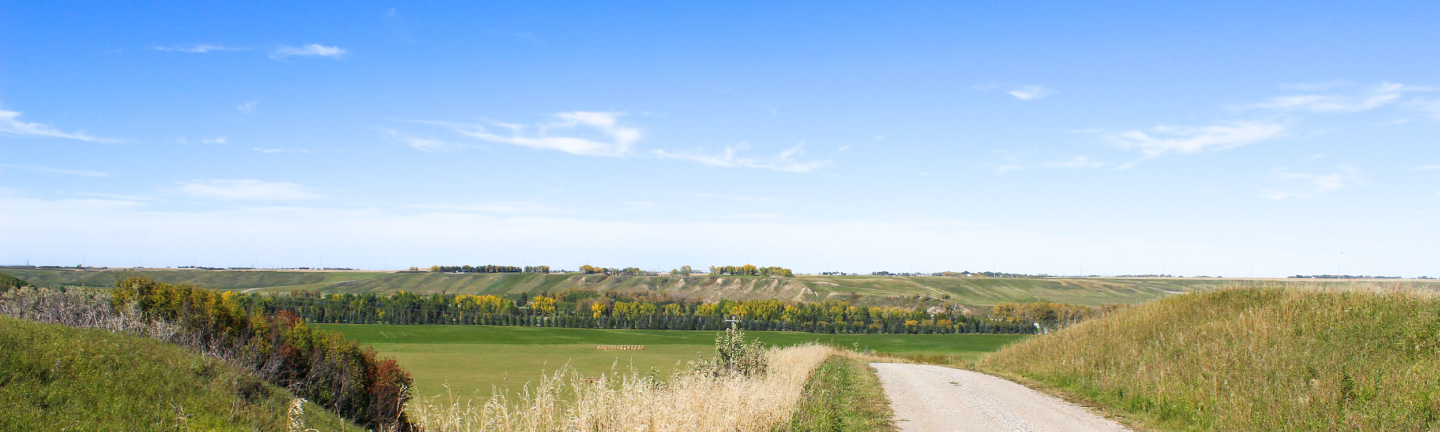
Located at the east end of Dunbow Road, the Oxbow lands are within the community of Davisburg and Foothills County. The lands are northwest of the confluence of the Bow and Highwood Rivers and in close proximity to the City of Calgary.
To the west, the lands are bound by 88th Street E and to the north by the Cottonwood Golf & Country Club, and the Bow River. A parcel of land owned by Foothills County and the Bow River bound the plan area to the east. To the south of the subject lands is Dunbow Road and a mix of agricultural uses and country residential homes.
The Oxbow lands are currently designated under the Agricultural and Country Residential land use district. As part of the Oxbow Area Structure Plan (ASP) we will submit a new land use concept to support the development of a complete community.
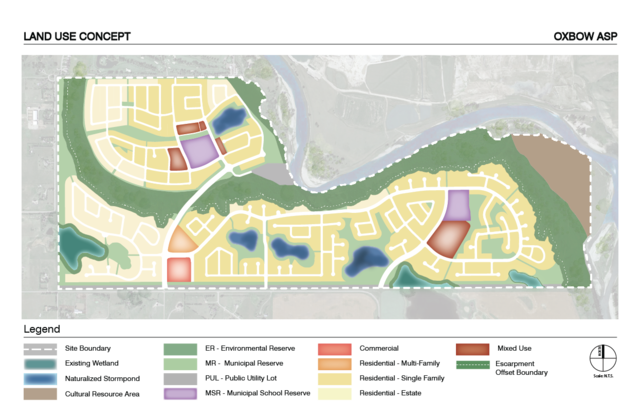
The image show is the land use concept for the Walton lands. We have updated the land use concept in order to reflect new stormwater planning features and waste water servicing options for the community.
The Oxbow lands are characterized by natural and historical features, including the Bow River, an escarpment, large natural wetlands and a buffalo jump. These natural landforms and historic features informed the evolution of our initial and current comprehensive vision and plan for the community.
Project Principles
The image show is the land use concept for the Walton lands. We have updated the land use concept in order to reflect new stormwater planning features and waste water servicing options for the community.

A Distinctive Community

Share the Land

Connect to Nature

Embrace the Past

Stewardship

Respectful Community Design
Why "Oxbow"?
The community name Oxbow is inspired by the geography and farming roots of the lands.
The development of Oxbow embraces the evolution of the lands while also acknowledging the importance and influence of the past.

An "Oxbow lake" begins to take shape when a river creates a wide meander. Over time, the meander is cut off from the river and forms an oxbow lake. Similarly, the Oxbow lands are bound by the Bow River to the north, where a sharp bend in the river has formed. Given enough time, it is likely than an oxbow lake would form where the current river channel flows north of the lands.

"Oxbow" is also a term for the "bowed' or U-shaped piece of metal placed around oxen when ploughing field or carrying heavy cargo. The oxbow is connected to a yoke, allowing the animals to work together and share the load.